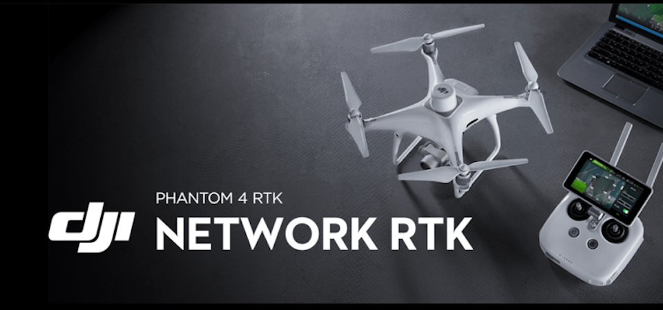
DJI Phantom 4 RTK Review: Revolutionizing Drone Mapping

Drone mapping has become one of the fastest growing areas of the drone-based service industry. With applications in construction, surveying, real estate, and infrastructure development, drone technology has been tapped by numerous companies worldwide to conduct drone mapping services that are faster, cheaper, safer, more accurate, and more efficient. Ever the innovator, DJI recognized this market demand and have just released their entry to the mapping drone market: the DJI Phantom 4 RTK.
What does the Phantom 4 RTK hold in store and how does it compare to high-end mapping drones? We took a look at the info that we have so far to answer these questions and these are what we found.
Accurate positioning using RTK technology
The heart of the Phantom 4 RTK is its integrated real-time kinetic (RTK) positioning system, located in a node at the top of the drone. This technology allows for centimeter-level accuracy: 1 cm + 1ppm horizontally and 1.5 cm + 1ppm vertically. The Phantom 4 RTK applies this level of positional accuracy to the image metadata, allowing it to generate extremely accurate aerial images and 3D maps.
With the superior accuracy of RTK positioning, mapping using the Phantom 4 RTK has the potential of decreasing survey time by up to 75% by reducing the number of Ground Control Points (GCP) needed. From a standard 40 GCPs per square kilometer, the number of GCPs may be reduced to 2 to 3. With the right conditions, it is even possible to conduct an accurate survey without a single GCP.
GNSS redundancy
In areas where signal reception is poor, the GNSS module that sits right underneath the RTK module takes over to allow the drone to maintain flight stability. With this redundancy, safe and optimal flight is ensured while continuing to collect precise and complete data for mapping and survey jobs.
Accurate data alignment with TimeSync
The Phantom 4 RTK comes with the brand-new TimeSync technology, which aligns all the data collected from the flight controller, onboard camera, and the RTK module. With perfectly aligned data, TimeSync ensures that the metadata applied to all images is accurate based on RTK positional data.
High quality and precise imaging system
The Phantom 4 RTK comes with the standard 1-inch CMOS sensor that is found in the Phantom 4 Pro, but it has been modified to serve the mapping applications of the RTK. Recognizing that each camera lens has variations in manufacturing, every piece of lens goes through a rigorous calibration process that measures image distortions and applies distortion parameters into the metadata of every image that the camera captures. This means that post-processing is unique for every camera.
A dedicated controller
At first glance, the controller of the Phantom4 RTK seems like the same controller as the Phantom 4 Pro, but it comes with a few upgrades to make it work better for mapping jobs. It includes a slot for a microSD card for the storage of survey data for post-processing. A built-in back up battery allows for a hot-swappable exchangeable battery to ensure that surveys do not get interrupted by dead batteries. Users also have an option to use a 4G dongle to connect the RTK positioning data to the internet using NTRIP (Network Transport of RTCM via Internet Protocol). Lastly, the controller comes pre-installed with the GS RTK app, providing an easy out-of-the-box solution for planning and executing mapping missions.
The controller was designed for multi-aircraft coordination. Up to 5 drones can be controlled using a single remote controller, allowing a single drone pilot to control a literal fleet of drones for exceptionally big mapping projects.
Easy flight planning and intelligent execution
The GS RTK app was specifically designed for the Phantom 4 RTK drone. KML files may be loaded into the app prior to going out in the field to be used as a rough background of the survey. Out in the field, the GS RTK provides two planning modes: Photogrammetry and Waypoint Flight. These modes allow you to overlay the target survey area on your KML files, exactly defining the flight path of the drone while setting mapping parameters such as overlap rate, altitude, camera parameters, and speed. The app was designed for ease of use, and DJI expects new users to get the hang of it in a matter of minutes.
Should the drone battery reach critical levels in the middle of the survey, it is programmed to pick up right where it left off as soon as the battery has been replaced. All survey plans can be saved into storage using the GS RTK app, allowing surveyors to conduct repeat surveys quickly and accurately.
Seamless video feed
The Phantom 4 RTK comes with DJI’s trademark OcuSync system that enables high quality and low latency video transmission at distances of up to 7 kilometers. This expanded range is the perfect solution for large mapping projects.
Compatibility with D-RTK2 Mobile Station
You can get even better mapping results using the D-RTK2 mobile stations, which interfaces seamlessly with the Phantom 4 RTK. The D-RTK2 supports the Phantom 4 RTK by providing differential distance data at a centimeter-level accuracy. Similarly equipped with OcuSync, the D-RTK2 delivers quick and accurate positional data at any condition.
Mobile SDK support
The DJI Mobile SDK is a software development kit that gives developers access to the features and capabilities of the DJI products. The Phantom 4 RTK was built with Mobile SDK support to allow users to create customized automated functions for the drone’s flight control, camera, and array of sensors.
Still the same old Phantom 4
Even with all the additional functions, the Phantom 4 RTK retains all the best qualities of the Phantom 4 series of drones. The Phantom 4 RTK uses the same propellers, and can even be used with the same ND filters as the Phantom 4 Pro. It has the same high-quality camera, 3-axis gimbal, and 5870 mAh battery that provides up to 30 minutes of flight time. Despite the added RTK module, the Phantom 4 RTK remains compact and highly portable. For mapping surveys that have to be conducted along several different locations, the portability of the Phantom 4 RTK is invaluable.
How much is it?
The Phantom 4 RTK retails for about $6,500. You also have the option of buying the Phantom 4 RTK bundled with the D-RTK2 Mobile Station for about $9,000. You can also buy the D-RTK2 Mobile Stations separately for $4,100. The Phantom 4 RTK starts shipping on October 2018, and the D-RTK2 Mobile Station is expected to follow one month later
At this price point, it is apparent that the Phantom 4 RTK was not made as a consumer-level drone. Casual drone pilots will not have any use for the advanced mapping functions of the Phantom 4 RTK, after all. This is a product the DJI made specifically to serve an industry need for a quick and accurate mapping tool. The price is very competitive compared to other RTK-equipped mapping drones that have been available in the past. For the price of a single RTK mapping drone, a company can buy a fleet of DJI Phantom 4 RTK drones – the perfect solution for high volume mapping needs.
Final thoughts
DJI continues to recognize opportunities in the drone market. Drone mapping is quickly becoming one of the most industry-relevant and lucrative drone applications, and the newly released Phantom 4 RTK should only serve to accelerate the growth of this service. With the Phantom 4 RTK, DJI successfully integrates the centimeter-level mapping accuracy of RTK technology with the superior camera quality and intelligent flight technology of the Phantom 4.
The pre-installed GS RTK app is heaven-sent for drone surveyors. Never before has there been a survey planning program as convenient and easy to implement as the GS RTK. The TimeSync and OcuSync technologies not only allow for close monitoring of the survey by the drone pilot, but they also help improve the accuracy of the survey data.
The Phantom 4 RTK has only started to make a buzz, but we believe that this drone will revolutionize the drone mapping industry as we know it. Mapping surveys are going to be done faster and cheaper while delivering even more accurate results. Best of all, the Phantom 4 RTK remains highly portable – load it in your car, strap it on your back, and head to where you want to take off. We are excited to see what experience drone surveyors can do with the Phantom 4 RTK once DJI starts to ship them out.