Drone GPS Navigation: What It Is and How It Works

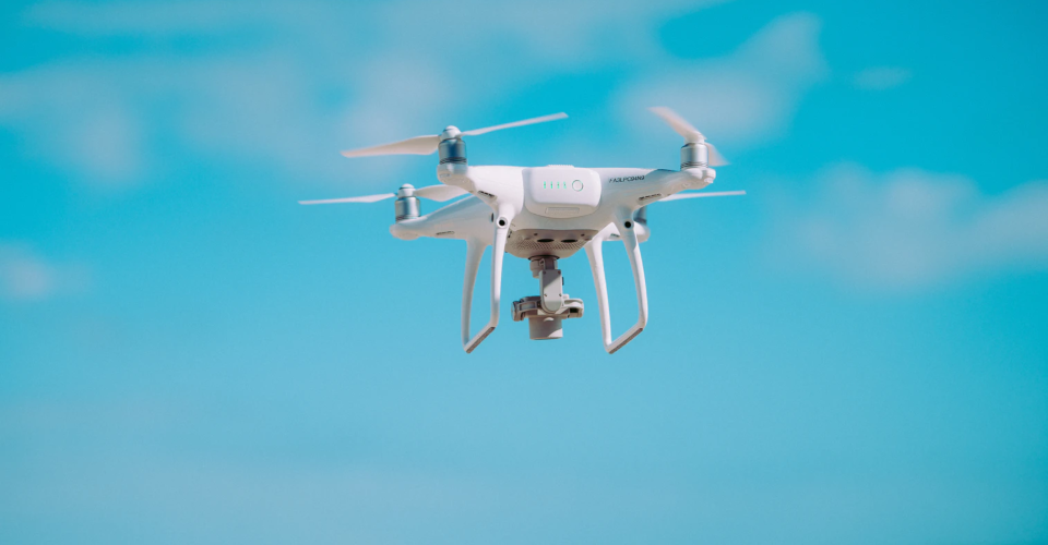
Drones can do what they do through a complex system of interconnected parts working together. Between the various sensors, motors, propellers, cameras, and transmitters inside a drone, a drone truly is a marvel of modern engineering that has become accessible to the common consumer.
One of the technologies that empower many of the drone’s more useful functions is onboard GPS. This GPS is no different than the ones used in car navigation devices or your smartphone. How exactly does a drone use GPS technology? What is GPS anyway and how does it work?
What is GPS?
The Global Positioning System (GPS), originally knowns as NAVSTAR GPS, is a satellite-based navigation and location system. Central to this system is the network of up to 32 satellites orbiting the Earth, although this number can have slight variations when older satellites are retired or replaced. Anyone with a GPS receiver can access the GPS network – this receiver is the one found in our phones, cars, fitness wearables, and drones.
It may come as a surprise to some, but the GPS network is only one of many satellite-based navigation systems that are currently operating. To be more precise, the GPS network is owned by the US government and is being operated by the US Air Force. The other popular alternatives include the Global Navigation Satellite System (GLONASS) owned by Russia, the BeiDou by China, and the Galileo by the European Union.
Collectively, these satellite navigation systems fall under the Global Navigation Satellite System (GNSS). It’s not unusual for a GNSS receiver to provide access to more than one of these GNSS networks. Many mid-range to high-end drones allow for redundant GPS and GLONASS navigation, just in case one of the other fails due to poor signal coverage.
How does GPS work?
The location of any GPS receiver can be accurately determined using the concept of triangulation. Each of the satellites in the network continuously transmits time-stamped signals which can be received by GPS receivers on the ground. These signals are sent as radio waves that travel at the speed of light.
By calculating the time it takes for the signal to arrive from satellite to receiver, the distance between the two can be determined. Using the data from multiple satellites, the accurate location of any GPS receiver on Earth can be deduced.
However, this is a very simplistic description of the mechanisms behind GPS technology. There are a lot of sources of errors and uncertainties which the system needs to address. The most important consideration is the need for the receiver’s clock to be perfectly synchronized with the satellites to allow for accurate time calculations. To remedy this problem, a common correction factor needs to be applied to all the satellite clocks and the receiver clocks.
There is also the matter of the satellites moving along the Earth’s orbit as they transmit signals. This movement, however slight, must be factored into the distance calculations. Some mathematical modeling can predict the trajectory of movement into satellites, thereby reducing the error in the time and distance information. However, it is still necessary to have ground-based measurement stations that track the location and movement of GPS satellites in orbit.
Lastly, the effects of traveling through the atmosphere on the speed of radiofrequency signals must also be considered. Radio waves can travel at the speed of light, but only in a vacuum. However, there is an inherent delay when they travel through the Earth’s atmosphere. These delays are predicted through mathematical models that take into consideration changes due to the effects of the ionosphere and troposphere and the changes in path length depending on the locations of the satellites and receiver.
To summarize, the system that GPS networks use to accurately determine the location of a receiver relies on real-time and rapid coordination and adjustment of data. Think of all that math and technology the next time you activate your phone’s GPS feature to search for directions to the nearest restaurant.
How does GPS help drone operations?
Modern society has become so dependent on GPS that it’s hard to imagine a world without this technology. Some applications may seem mundane but are undoubtedly useful in our daily lives. GPS has allowed us to open up maps on our phone with real-tine navigation aids, location-specific data, and traffic information.
On a larger scale, GPS has allowed for safer air traffic control, providing a faster and more accurate alternative to radar-based tracking systems. On the innovative front, GPS technology has given way to the possibility of self-driven cars. This is admittedly still a niche technology but who’s to say that they won’t be the new normal in a dozen or so years?
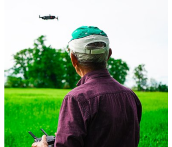
The miniaturization of GPS technology has allowed them to be part of the regular equipment of drones. Nowadays, even lightweight ultra-portable drones have been outfitted with GPS technology. GPS has improved drone flight on two fronts – safety and autonomous flight.
Safety has always been at the forefront of drone development, and GPS technology has become the go-to enabler for many safety-related features. From modes that make drones beginner-friendly to more comprehensive tracking and geofencing, GPS has drones more accessible and drone pilots more accountable with regards to airspace safety.
GPS technology is the cornerstone of automated flight, one of the more advanced functions of modern drones. Not only is it incredibly fun to watch a drone fly around with minimal pilot input, but the accuracy and repeatability of GPS-aided drone flight have also opened the doors to so many commercially useful applications of drones. From agricultural management to search and rescue operations, the integration of drones with GPS has been a revolutionary step for the wider adoption of drone technology across several industries.
Features made possible by GPS navigation
1. GPS stabilization
One of the most important features made possible by GPS is GPS stabilization. This allows the drone pilot to command the drone to simply hover in place without any manual input. While hovering, the drone will make slight adjustments to its position whenever it drifts away due to wind.
The drone can do this by determining a current GPS position. Should it move away from this position, it will fly back immediately and automatically. This feature has proven to be very useful for drone photographers who can simply tell their drones to hover in place while they line up and frame their shots. With the accuracy of GPS receivers, drones can now maintain such a stable position that they can shoot time-lapse videos.
2. Return to home
When a drone loses its link with the remote controller or if its battery power goes below a threshold level, it will typically activate its return to home (RTH) feature. This will make the drone fly back either to its original take-off position or the current position of the remote control. This safety feature has probably saved a lot of drone pilots from having their drones fly away or crash because of dead batteries.
3. Subject tracking
Some of the more advanced camera drones can identify a subject and follow it automatically, all the while keeping it within focus of the camera. This has given way to amazing cinematic opportunities for people riding bikes, hiking along a trail, or skiing down the snowy slopes.
While optical recognition plays a part in most drones that have these features, some also offer the option of GPS-aided tracking. This makes use of a handheld beacon that the subject holds while they move, allowing the drone to follow them based on a GPS position. While handheld beacons are quite rare, they are undoubtedly useful, especially for drone pilots who don’t want to have to bother with bulky remote controllers.
4. GPS waypoints
With GPS waypoints, a drone pilot can simply prescribe a flight path for the drone to automatically follow. The drone will then fly from one waypoint to another, stopping only when instructed by the pilot, when the batteries go below critical levels, or when the path has been completed.
This may sound like a simple description, but this single capability has made drones very useful tools in wide-area surveillance and remote sensing studies. Automated drone flight is a central component to drone-based mapping, precision agriculture, thermal mapping, or any type of data gathering studies that make use of the unique perspective that drones provide.
When surveying an area, the drone pilot merely needs to prescribe a scope of the survey or a specific flight path for the drone to follow. The drone will then fly along this path, gathering whatever data is needed. Aside from the lack of pilot intervention, the benefit of this feature is that it allows flight paths to be saved and replicated if necessary.
5. GeoFencing
GeoFencing is a relatively new thing in the drone market – the ability for a drone to recognize when it is in controlled or restricted airspace and refuse to fly without the proper authorization. This is quite a controversial matter with drone pilots complaining about how restrictive it is and drone manufacturers standing by the safety-enhancing value of the feature.
Basically, GeoFencing works by comparing the GPS position of a drone with a database of areas of controlled or restricted airspace. If the drone is within any of these no-fly zones, then it must be unlocked before any flight is possible. There are several ways to unlock a drone depending on the level of flight restrictions of a no-fly zone.
It’s tough to say if GeoFencing will go on to become a standard feature in drones moving forward. While national airspace safety is of utmost importance, the ability of drone pilots to fly their drones without the red tape also cannot be ignored.
Final thoughts
GPS technology has been so deeply ingrained into drones that it’s hard to imagine how drones can do without them anymore. This isn’t likely to happen given the accessibility of GPS technology nowadays. If anything, we expect onboard GPS to become even better in the coming years.
Are there other ways in which GPS can be used? There’s already one on the horizon – the Remote ID system that is being proposed by the FAA. That is a whole separate can of worms which we’ll have to talk about separately, but there’s no doubt that GPS technology will play a central role in it should the proposal translate into actual regulations.