Land Surveying Using Drones: Benefits, What to Consider, and How It’s Done

Land surveying is a practice that is as old as written history. It’s a crucial step in all forms of construction, transportation, and mapping, and is commonly done to establish the boundaries of land ownership. Of course, the methods of land surveying had evolved from the time when the ancient pyramids were built. Nowadays, radar locations systems and remote sensing technologies have made land surveying easier and more accurate than ever.
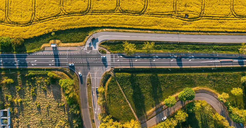
Drones represent the newest technology that seems to be on the precipice of mainstream adoption in the field of land surveying. How are drones used in land surveying, and what are its benefits? What should you consider before using a drone for land surveying?
What is land surveying?
The term ‘land surveying’ encompasses a technique, science, and a profession that is concerned with the mapping and measurement of a pre-defined environment and any relevant features. It is a critical component of any civil engineering project, is used to determine the legal boundaries of any property, the topography and slopes of any piece of land, and the exact location of any existing piece of infrastructure. Land surveying isn’t limited to just ‘land’ as we traditionally know it – land surveyors have used sophisticated techniques to map the ocean bed and the polar ice caps.
Land surveying is such a standard practice that you’ve probably seen surveyors at work at some point. The surveyors, wearing their high-visibility vests, can often be found looking through tripod-mounted equipment. These are called theodolites or total stations and are used to measure the angles and distances between points. Depending on the distance between the total station and the point being measured, the data might need to be corrected to account for the effect of light refraction and the Earth’s curvature.
All the data that surveyors collect on the ground are then consolidated using software such as AutoCAD or ArcGIS to recreate an accurate, three-dimensional map of their survey area. This model can then be used for project planning and to take more distance, area, and volume measurements.

PART 107 Made Easy
- 161 Question and Answer Study Guide
- 105 pages of illustrated content
- Covers all parts of the Part 107 test
- $97 of value for free
Why use drones for land surveying?
While the method of point-to-point measurements using total stations has been time-tested and proven to be reliable, it’s also really tedious and time-consuming. Finishing a land survey using this method also takes a lot of hardware and manpower, the costs of which also drive up the price for a ground-based land survey.

The method requires surveyors to be in the thick of things and actually be inside the survey area. For areas that are geologically hazardous or otherwise difficult to access, this may not be possible especially while carrying all of their survey equipment.
Drones offer solutions to many of the issues of traditional land surveying techniques. Among its many benefits, the most important are as follows:
1. Less effort
Compared to having to stand under the sun for several hours to take several measurements using total stations and GPS devices, flying a drone is much easier. It does take a bit of setup, but once you’ve set the survey area or flight path that you want your drone to cover, it can pretty much do all the work automatically.
Depending on the degree of accuracy you want for your survey or the type of mapping technology you are using, you might still need to establish a few ground control points (GCPs) within your survey area. This involves having to go out in the field and placing large and clear marks at certain points within your survey area. This takes a bit of work but is nothing compared to the effort of having to take hundreds of measurements using total stations.
2. Faster
With reduced manpower and faster data acquisition, land survey jobs can be completed in much shorter periods with drones. A land survey that can take several weeks to finish can be done over a couple of days with just a single drone. With the dawn of cloud-based data processing, drone survey software can offer faster post-survey data processing even without powerful hardware.
3. Cheaper
In the past, remote sensing for land surveys required having to fly a helicopter while hundreds of aerial images are captured onboard. While this vastly speeds up data acquisition, it’s also a very expensive option. Renting a helicopter, paying for the fuel it will consume over several days, and paying for the services of a licensed and trained helicopter pilot can cost a small fortune.
On the other hand, drones are practically just a one-time expense. Once you have the drone, the accessories, and the proper software, you’re basically all set to do an aerial land survey. You might have to, but a few replacement parts such as propellers, but those are usually pretty cheap.
You don’t need a lot of training to fly a drone. In fact, most drone pilots are self-taught. However, we still recommend any of several free and paid training courses, most of which can be taken online.
4. Repeatable
Survey planning apps typically offer automated survey capabilities. The surveyor only needs to define a survey area or a flight path for the drone to follow, and the survey will proceed even without any further user intervention. This ensures that data acquisition is done precisely as needed by the software to generate an accurate model of the survey area.
Another great thing about automated features is that survey parameters can be saved and re-used when needed. This is great for surveys that need to be repeated, typically to document the changes in a survey area. Repeat surveys can be requested to monitor the progress of a construction project or to check for signs of changes in topography.
In summary, the benefits of using drones for land surveying can be summarized in one word: efficiency. With drones, land surveyors can create the same results with much less cost, resources, and manpower involved.
What should you consider before doing drone-based land surveys?
If you are considering making the jump to using drones instead of ground-based methods for land surveys, then you’d best be ready to make a significant investment. Before you make that big purchase, here are a couple of factors you need to think about:
1. Photogrammetry vs. LiDAR
There are two major technologies available to drone-based land surveyors: photogrammetry and LiDAR. Either one is extremely popular in the aerial mapping industry. The choice of which technology to offer as your service comes down to a compromise between accuracy and cost.
Land surveying through photogrammetry relies on a series of overlapping aerial photos. These photos will then be processed and stitched together by a dedicated photogrammetry software to deduce the depth of individual features in the photos. Photogrammetry does not rely on any highly advanced hardware – any drone with a high-resolution camera and a GPS module will do.
LiDAR is a little more complex. Instead of a camera, a LiDAR sensor continuously emits and receives pulses of non-visible light. These beams of light are reflected by the features in the survey area. The time it takes for these beams of light to return to the sensor is then processed post-survey to deduce the dimensions of individual features.
The main advantage of photogrammetry is its simplicity. Since most high-end turn-key drones are equipped with enough hardware for photogrammetry, the barrier to entry is very low. It’s also much less costly – you can probably get a good camera drone for less than $2000.
On the other hand, LiDAR is much more versatile and accurate. Since it does not rely on visible light, it can complete survey jobs in darkness and even map features that cannot be seen in photos. Laser light can also penetrate through vegetation, making it the preferred method for surveying of heavily forested areas. LiDAR can typically guarantee survey accuracy to a minimum of 1 meter – a huge upgrade to the 5 to 10-meter accuracy of photogrammetry.
However, LiDAR survey setups are much more expensive. Just the LiDAR sensor can cost between $50,000 to $300,000. They can also be quite heavy, which means that you’ll need a high-end drone with heavy payload capabilities. Combining the cost of the drone and the LiDAR sensor, you can expect to spend up to $350,000 for industrial-grade LiDAR setup.
2. Fixed wing vs. Multirotor
Although multirotor drones have become extremely popular in the last couple of years, there is still a community that prefers to stick to fixed-wing drones. Either type is perfectly viable for land surveying. There are, of course, benefits and limitations to choosing either a fixed-wing or a multirotor drone.
The main reason that multirotor drones have become so popular is that they are easy to fly. This also translates to drone-based land surveys. Learning how to fly multirotor drones will only take a few hours. Multirotor drones also have the unique advantages of being able to take off and land anywhere and hover in place.
They are typically smaller and easier to carry around, especially considering the recent trend of ultra-portable drones such as the Mavic line from DJI. Since the market is flooded with multirotor drones, they also tend to be the more affordable option.
On the other hand, fixed-wing drones have the advantage of being able to fly further and longer on a single battery cycle. Since a fixed-wing drone can generate lift even without its rotors, it can recover and land safely if its battery dies mid-flight. These come at the price of requiring a higher level of flight skill for the drone pilot.
A fixed-wing drone cannot hover in place, may require a runway to take-off and land, larger and less portable, and typically more expensive.
3. Software
Aside from the equipment needed to do drone-based land surveys, you’ll also need to invest in good software. There are a lot of good options out there, but we recommend looking for a software platform that offers the following:
- A free trial period – This will allow you to assess if this software fits your needs. If you are still new to the industry, this is an excellent option for getting your toes wet and learning how mapping software works.
- Good customer support – We recommend that you read up on customer reviews before committing to a particular mapping software. Does the platform provide a good user guide and tutorial? Is there a dedicated hotline for customer support and troubleshooting? How often do they release updates? Customer support can make the difference between a mediocre and excellent mapping software platform.
- Ease of use – This is a subjective matter, and how easy a software is to use depends on your preferences. Is the interface user-friendly? Can you figure out how to use all the features with the tutorials that the developer provides? If your software offers a trial period, then the ease of use factor should certainly be one of the things you “trial.”
- File export formats – As a land surveying professional, you need to be flexible in your ability to work with other professionals in the same field. You might also need to pass the output of your mapping software to other industry-standard software such as AutoCAD or ArcGIS. This means that your mapping software should be able to export files in a variety of file formats.
- End-to-end solutions – A good mapping software should offer not just post-processing capabilities but also have a reliable survey planning module. These are typically offered as mobile app extensions. By working within the same software ecosystem, you can avoid running into compatibility problems when passing over your survey data to the post-processing platform.
Despite seemingly stringent requirements, there are a couple of good options that offer all the qualities you could be looking for in mapping software. PrecisionMapper by PrecisionHawk is an excellent choice for processing of aerial images to create 2D and 3D maps. PrecisionHawk even offers a completely free version with limited features.
If you’re a beginner, then the RAPID photogrammetry processing software by DroneMapper is a perfect choice. It’s quite a simple platform with modest capabilities – it can only process 150 images per project and does not offer cloud-based processing. However, it covers all the basics and produces orthomosaics and digital elevation models (DEMs).
Finally, Pix4D is undoubtedly one of the most popular choices when it comes to drone mapping software. With almost a decade of experience in the field, the Pix4D platform offers a huge suite of specialized software modules and algorithms. The software is highly versatile and can be used for practically all types of mapping applications. However, the complexity of Pix4D doesn’t lend well to user-friendliness – it doesn’t exactly hold the hands of beginners.
Final thoughts
Shifting to drone-based technologies for land surveying holds a ton of potential. By completely changing the way things are done, drones make land surveys cheaper, faster, and more accurate. There are already several excellent examples of drones being used for land surveys. If this something you’re interested in, then the good news is that the market is still ripe for the taking.
Before jumping into the fray, we recommend stopping to think about the kind of service you want to offer. Your choice mapping technology, drone technology, and mapping software will heavily depend on your target market. One thing to keep in mind is that it’s not going to be cheap, but the initial investment can be easily offset by your potential earnings.
You made a good point that the software being used in drone surveying is something to consider when getting such a service. A friend of mine might need that kind of service soon because he is planning to build a ranch on the unused parts of his land. It would be very important to know more about the land he is working with before doing anything.
http://www.communitysciences.com/dronesurveying.html