What Sensors Do Drones Use?

With modern drones being made to maximize ease-of-use, it’s also become easy to take for granted just how complex and well-designed these drones are. Aside from the mechanical components that allow a drone to generate lift and maneuver in mid-air, drones also employ an array of sensors that constantly collect information from their surroundings. With this information, drones can maintain their positions, determine how fast they are, and avoid obstacles. What exactly are these sensors and how do they work?
1. Gyroscope
The most basic of drone sensors, gyroscopes are cheap and basic enough to be integrated into even cheap mini-drones. Despite the very simple scientific principles that govern how gyroscopes work, they are still highly essential tools that are used for navigation in high-end aircraft and space shuttles.
Gyroscopes work on the principle of conservation of angular momentum. Simply put, a gyroscope consists of a spinning disk that is mounted on a frame. While the disk is spinning, the axis of its rotation remains in place, regardless of the tilting or rotation of the frame where it is mounted. By establishing an inertial reference frame, a gyroscope can be used to determine the rate of rotation, degree of tilt, and angular velocity of a moving object.
Gyroscopes are an all-around tool used for measuring or maintaining orientation. By integrating three accelerometers, each of which is oriented in a different axis, the degree of motion of a drone in any axis can be determined. This helps in collecting information on the drone’s roll, pitch, and yaw, and feeding back this information to the drone’s proportional-integral-derivative (PID) controller.
In practically all drones, gyroscope technology is heavily employed to help maintain a stable hover. When there is no input from the pilot, any wayward drifting or wobbling by the drone is detected by the gyroscope. This information is then relayed to the PID controller, which commands the drone’s motors to counteract the unwanted movements. Gyroscopes are so essential to the stable operation of a drone that a malfunction in the gyro sensors will very likely result in a crash.
2. Barometer
Barometers are sensors that measure air pressure. In drones, this air pressure information is used to determine the drone’s altitude. The principle and technology behind this process are pretty simple, but air pressure readings are prone to drifting due to winds or any rapid changes in the drone’s movements. To ensure their best performance, barometers need to be periodically using air pressure readings at the local sea level.
Barometers are found in almost all drones and are mostly used to aid in maintaining a stable altitude. Autonomous drone missions were changes in altitude are essential also make use of the readings from the onboard barometer. Although GPS technology can also be used to determine the altitude of a drone, barometers produce much more accurate data and provide faster feedback, as long as they have been properly calibrated.
3. Accelerometer
The accelerometer of a drone works together with its gyroscope to determine changes in its position and movement. Where the gyroscope specializes in reading rotational movements, an accelerometer performs better in reading linear movement along any axis. Accelerometers, in combination with GPS technology, allow your smartphone or fitness device to track your route when you are running or traveling.
So how do these accelerometers work? There are a couple of accelerometer types that function in different ways, but most accelerometers rely on the piezoelectric effect. A piezoelectric accelerometer uses microscopic crystals that generate a current when they undergo stress. This stress can be brought about by accelerative forces, such as the movement of an object.
Aside from the work done by gyroscopes, accelerometers also aid in allowing a drone to maintain a stable hover. The principle is essentially identical. Any movement of the drone caused by external forces, such as a strong gust of wind, will be detected by the accelerometer and relayed to the PID controller. The controller then commands the motors to counteract the movement.
The combination of 3-axis accelerometer and 3-axis gyroscopes is what is commonly referred to as 6-axis gyro stabilization. This setup allows a drone to maintain horizontal, vertical, and rotational stability while hovering. For applications such as professional-grade drone photography and 3D imagery, 6-axis gyro stabilization is a must.
4. GPS
GPS technology has played a huge role in allowing drones to fly autonomous missions. It’s not a feature that can be found in all drones but is a pretty standard inclusion for prosumer-grade models. By comparing the actual position of the drone with its targeted position, the PID controller determines which way the aircraft should move and instructs the drone motors with the appropriate commands.
The principle behind GPS technology is pretty simple. A drone is outfitted with a GPS receiver that can receive signals from several GPS satellites. Depending on the location of the satellite source, the time it takes for the drone’s GPS module to receive the signal will vary. By triangulating the relative position of the drone from the different GPS satellites, the location of the drone in a specified geospatial reference system can be determined. The accuracy of the location will depend on the strength of the signal that the drone’s GPS module receives and the number of satellites within its range.
Despite the prevalence of GPS technology, it is not a foolproof method for determining a drone’s location. Since it relies on the reception of signals from satellites located along the Earth’s orbit, flying under any canopy cover will drastically reduce the ability of a drone to determine a GPS location.
Autonomous flight modes using GPS location will also only function if the drone can identify a ‘heading’ – basically an indication of where the North direction is. Although it’s possible to determine the heading based on the drone’s movements and relative GPS locations, this can only be done as long as the drone is constantly moving. There’s also a bit of latency using this method, so the ability of the drone to follow a pre-programmed route may not be as accurate.
5. Magnetometer
In cases where determining the drone’s heading using only GPS location is not appropriate, a drone needs to have a magnetometer. As its name implies, a magnetometer measures the strength and direction of a magnetic field. Using this principle, a drone can always determine the direction of the magnetic North and adjust its trajectory accordingly.
Unfortunately, it can be very easy to throw a magnetometer off its course. Anything that emits a magnetic field – such as power lines, motors, and other electrical devices – have the potential of disturbing the magnetometer’s ability. This can be avoided from avoiding such disruptive sources and performing a calibration of the magnetometer periodically.
6. Rangefinder
There are different types of rangefinders found in drones but all of them perform a simple task: to determine how far away from the ground the drone is. If it sounds like a rangefinder’s function would be redundant with that of the barometer, then you’re right: a rangefinder is basically an alternative to a barometer that has a more limited scope but is much more accurate.
For a rangefinder to function as intended, it needs to be pointed to the ground at all times. The most common rangefinders use sonar technology. By receiving sound waves from the direction of the ground, a sonar rangefinder can deduce the altitude of the drone. A laser rangefinder works in pretty much the same manner except it uses lasers in place of sound waves. Laser rangefinders have a bigger range but are also more expensive.
The main drawback of using a rangefinder is that it only works when the drone is hovering close to the ground. You may be wondering: given the limited range, why use a rangefinder in the first place? The answer lies in accuracy. The altitude reading of a rangefinder is unaffected by drift or sudden changes in wind strength. It also takes into account minor variations in topography.
7. Inertial Measurement Unit (IMU)
An IMU is not exactly a separate sensor of the drone but is instead a collaboration of several sensors. In most cases, a drone’s IMU consists of accelerometers, gyroscopes, and magnetometers, each set of which works in all three axes of movement. By combining the capabilities of all these sensors, an IMU can detect changes in location and rotational attributes related to an aircraft’s roll, pitch, and yaw. By detecting the orientation and strength of magnetic fields, an IMU can even enforce on-the-fly calibration against orientation drift.
Before drones were even a thing, IMU modules have formed the backbone of the navigation systems of manned aircraft, satellites, space shuttles, and missiles. Nowadays, IMUs are so common that they can be found in almost all smartphones and tablets, some game controllers, and self-balancing hoverboards.
IMUs allow drones to determine their location via a process called ‘dead reckoning.’ In this method, the drone’s position is determined using a previously determined location and the estimated speeds over the period of time from the previous reading. In simpler terms, an IMU continuously integrates the acceleration of the drone to calculate its velocity and position. This technology allows the drone to determine its approximate location even when GPS signals drop off, such as when flying indoors.
A disadvantage of the IMU’s use of multiple sensors is that the error that the sensors generate tend to accumulate. Since velocity and location are determined by integrating the acceleration of the drone, any error in the acceleration numbers will result in exponentially higher errors in both location and velocity. The ‘drift’ caused by these errors can also get larger over time.
For this reason, periodic calibration of a drone’s IMU is strongly recommended. Software-assisted IMU calibration has bene the norm for modern drones, so this shouldn’t be much of a chore.
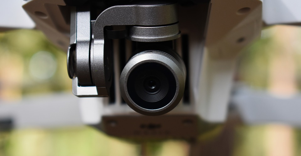
8. Obstacle avoidance
Obstacle avoidance sensors isn’t exactly a standard feature in drones. In fact, you would probably only find these sensors in the more expensive and higher end models. Still, obstacle avoidance features are highly sought by many drone pilots. As drones become even more sophisticated, we can expect drone manufacturers to compete with each other to see who can produce a better, more reliable, and more accurate obstacle avoidance system.
Different drones take different approaches to obstacle avoidance. Stereoscopic sensors combine images from two different cameras to infer the three-dimensional shapes of the features around it. Ultrasonic sensors both transmit and receive ultrasonic waves, deducing how far away the drone is from potential obstacles using the time difference from signal emission and reception. Infrared sensors work in much the same way, except they use infrared signals that are less prone to interception.
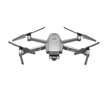
DJI has been known to combine different obstacle avoidance technologies in their drones. For instance, the omnidirectional obstacle avoidance of the Mavic 2 uses infrared sensors at the upward and downward directions while all the forward, backward, and lateral sensors use stereoscopic technology.
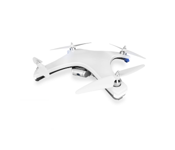
Yuneec drones have famously used Intel RealSense technology for obstacle avoidance. This technology uses a dedicated camera to construct a 3D model of its surroundings using a stereoscopic technique. RealSense can remember the models it has constructed, enhancing its capability to avoid obstacles should it return to a location that it has already modeled.
Final thoughts
In many ways, the sensors of a drone can be considered as its eyes and ears. Through its various sensors, a drone can determine its location and orientation in 3D space. This valuable information acts as the foundation for a drone’s navigation and control systems, allowing to either maintain a stable position or move towards the direction intended by the pilot.
Improvement in sensors – coming up with sensors that are more accurate, more responsive, and accumulate less error – is likely one of the next frontiers in drone innovation. We have already seen this happening in more recent drones with sophisticated obstacle avoidance systems and IMU-assisted GPS technology. Understanding how these sensors work allows us, drone pilots, to appreciate all the work that goes into making our little flying machines stay in the air.
Hello can i ask a question? What sensor will i use to measure the light pollution?
Before film cameras became automatic, we used a lightmeter to determine the average scene light level and then referred to a chart to determine the camera shutter time and lense iris opening according to the film sensitivity rating. So just research “lightmeter”.
Does anyone know of any drones out there that can support (CBRNE) sensors?
Chemical, Biological, Radiological, Nuclear and Explosive) I am working on a paper for my graduate class in homeland security at UMGC