How Accurate are Drone Surveys?

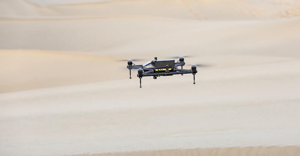
In recent years, drones have infiltrated and disrupted several large industries such as photography, filmmaking, advertisement and surveillance. With drones becoming even cheaper and more capable, this is a trend that will likely continue in the future. One industry that has been greatly changed by drone technology is mapping. Drone mapping is cheaper, faster, and less labor-intensive than other methods and it can potentially produce visually appealing and accurate models of any survey area, even when they are inaccessible to traditional mapping methods.
Considering how accessible drone technology is, hundreds of individuals and businesses offering drone mapping services have started to pop up. If you are a potential client, how will you know if these service providers know what they are doing? In this article, we focus on what must be the most important metric in assessing the quality of mapping project – accuracy.
Photogrammetry vs. LiDAR
Before we jump into discussing the accuracy of drone surveys, we must make a distinction between the two most common technologies used in drone mapping: photogrammetry and LiDAR.
Photogrammetry creates a 3D model of the survey area by taking successive high-quality images that overlap at varying degrees (usually 60% to 90%). By overlapping images, the depth of individual features in the images can be deduced. This is a technique similar to how our brain interprets the images visible in each individual eye to determine depth. This is a fairly simple technique that uses affordable and accessible technology.
The other technology is Light Detection and Ranging (LiDAR), which uses sensor that continuously emits pulses of light outside the visible spectrum. These pulses of light reflect off individual objects in the survey area and are then measured by the sensor. The time it takes for the light to return is used to determine the size and location of individual features of the survey area. This is a much more technologically demanding type of survey that uses specialized and much more expensive sensors. However, it has the advantage of penetrating through obstacles such as vegetation. A LiDAR survey can also be conducted in poor visibility areas since it does not rely on visible light.
The different approaches of photogrammetry and LiDAR mean that assessing the accuracy of one over the other may require a different set of metrics. Techniques for enhancing the accuracy of output models will also differ from one technology to the other.
What is accuracy?
The accuracy of a 3D model or map can be measured either as relative accuracy or absolute accuracy.
Relative accuracy refers to the relationship of individual features to one another. Determining relative accuracy may be as simple as measuring the distance between two points in your model and comparing this distance to the actual measured distance in the real world. For simple applications and small survey areas, relative accuracy is a good enough metric. It allows the client to determine accurate distance between features, as well as measure their volumes and height differences.
For professional-grade surveys and maps, quality is measured by absolute accuracy. This refers to the locational accuracy of the map with respect to their true position on Earth using an established geodetic coordinate system. This makes the resultant model consistent with globally observed standards. A model with good absolute accuracy is also necessary if it is meant to be combined with other data layers, such as publicly available GIS raster or vector data.
What level of accuracy do I need?
While it may seem like a good idea to target as high an accuracy as possible for your maps, it will also result the project taking much longer to finish and will be more expensive. In most cases, it is more practical to set accuracy targets based on the context of the purpose for the maps being made.
For projects focused on visual assessment and monitoring, relative accuracy should be enough of a metric for quality. The most common examples of these jobs are the monitoring of construction projects or monitoring of the health of crops in farms. Maps that are made for small-scale measurements, such as for determining the volume of stockpiles or the area of a field, are also served well enough by relative accuracy.
For many clients, high-quality maps are desired merely as marketing tools. If a project only needs a map to be visually appealing, investing on anything more complex than relative accuracy will be impractical.
Maps that rely on absolute accuracy are usually made to define the boundaries of large-scale construction projects, or for maps that are meant to be used together with other geo-referenced spatial data. Urban planning and infrastructure firms may require highly accurate topographic maps to plan for roads, drainage, and to identify potential flood plains.
What factors influence drone survey accuracy?
In photogrammetry, a critical factor of spatial resolution is Ground Sampling Distance (GSD). This refers to the distance between two pixel centers as measured on the ground. In simpler terms, it is a measure of the pixel size as overlaid on the actual survey field. The value of the GSD for any particular photogrammetry survey depends on the resolution and focal length of the camera being used, as well as the hovering altitude that the drone maintains during the survey.
For instance, the 1/2.3” sensor 12MP camera of the DJI Mavic Pro allows it to achieve 1 cm GSD at an altitude of 25 meters. On the other hand, a highly specialized survey drone such as the Lancaster 5 from PrecisionHawk achieves the same 1 cm GSD by hovering at a much higher and easier to maintain 60 meters.
Theoretically, LiDAR technology should be capable of achieving much higher accuracies. Ground-based static laser scanners have been used by survey companies for several years, and they have proven to be capable of achieving accuracy in the 5 to 6 mm range. However, drone-mounted LiDAR sensors have to contend with the additional challenges of being under constant motion. The LiDAR sensors will undergo rotation, tilting, acceleration, and change in attitude, and all these imperfections need to be integrated into the post-processing of the data. This is where the value of a good GPS receiver and inertial measurement unit (IMU) comes in, as they provide the capabilities needed for data correction.
One of the most reliable ways to enhance the accuracy of an aerial survey is by establishing Ground Control Points (GCPs). GCPs are pre-determined points that can be used to calibrate the absolute orientation of the reconstructed model. The location of each GCP is measured using professional-grade GPS or GNSS receivers, and they are marked with a distinct visual symbol to make them visible in the final map. The accuracy of the results of any aerial survey is limited by the accuracy of the GCP locations using the selected geodetic coordinate system – it is impossible to achieve a higher accuracy.
Beyond the hardware and software being used, changing the flight parameters can also result in improvements in survey accuracy. Flying at lower altitude can result in shorter GSD, and consequently an improvement in model resolution. Flying the drone slower can be done to increase overlap rates, which can result in more accurate sizes and locations of individual features. It is also generally recommended to conduct aerial surveys in clear weather for improved visibility and for better GPS signal reception.
Can RTK-enabled achieve high accuracy without GCPs?
Some RTK-equipped aerial survey systems boast of the capability of being able to conduct accurate surveys without the use of GCPs. While it is true that an RTK-enabled positioning system can attain centimeter-level accuracy, the truth is that the accuracy of an aerial survey depends on a few other factors. The quality of the IMU, the timing calibration of the camera trigger, and the positional calibration of the camera gimbal all play a role in contributing towards the overall model accuracy. This means that while an RTK system allows you to perfectly determine the position of the drone, it does not provide assurance that each pixel of each image it takes is assigned to the correct location according to a geodetic coordinate system.
Moreover, not establishing even a single GCP is a very poor survey practice that relies solely on the results of a complicated post-processing algorithm. These algorithms are already integrated into the particular mapping software, giving the user no opportunity to fine-tune or customize them according to their needs. Having even a small number of GCPs allows the surveyor to check the results after post-processing of the data to determine if there is a need to apply corrections or to reconduct the survey.
What accuracies can you expect from drone surveys?
As mentioned, the accuracy of a photogrammetry survey depends on the GSD, which in turn depends on certain flight parameters and the quality of the drone camera. Most literature state that you can expect an accuracy of 1 to 3 times the GSD for any reconstructed model, both vertically and horizontally. Using our previous example of 1 GSD using the Mavic Pro at a hovering altitude of 25 meters, we can reasonable expect an accuracy 1 cm to 3 cm.
In practice, you will probably experience some variation in accuracy depending on the regular or smooth the terrain is. Model accuracy will suffer in areas that have no visually distinct features such as forests or deserts, since producing a mosaic is a little more difficult. Vertical accuracy is usually about 50% lower than horizontal accuracy due to the complexity of deducing depths using overlaid images.
The accuracy of a LiDAR survey is heavily dependent on hardware quality. The concept of LiDAR itself lends it to an extremely high millimeter-level accuracy, but the quality of other sensors is equally as important. For instance, the ScanLook mobile LiDAR module can achieve 5 cm to 6 cm accuracy when relying solely on the onboard GPS/GNSS module for locational data with no GCP calibration. Under ideal circumstances, such as a good GPS constellation and tight distribution of GCPs, the accuracy of the reproduced model could be improved to around 5 mm to 6 mm.
In summary, it is difficult to come up with a definitive answer on the accuracy of any aerial survey. Although accuracy improvements can be attained by using better hardware and post-processing software, the conditions under which the aerial survey were conducted also play a crucial role. Flight altitude, flight speed, overlap rate, and weather conditions are just some of the aspects of a survey which may vary from case to case.
Final thoughts
The unique capabilities of drones have made drone mapping one of the best and most practical industrial uses of drone technology today. No longer do surveyors have to take multiple location and heading measurements on several stations in a survey area. With drones, survey jobs that used to take several weeks to finish can be completed in a matter of a few hours. Drone surveyors are also inherently a safer and more cost-effective alternative for surveyors. Long-term monitoring of survey areas for changes such as land subsidence is also made easier with fully automated and easily repeatable drone surveys.
However, the use of drones for aerial surveys does not change the fact that accuracy is still the most important metric for success. Depending on the purpose of the survey, a surveyor may opt to aim for excellence in either relative or absolute accuracy. Although it may be tempting to target absolute accuracy at all times, it may not be practical from a time and cost standpoint.
The difference in technology of photogrammetry and LiDAR means that there are different parameters that affect their accuracies, and that they have different values for baseline accuracy. Photogrammetry relies heavily on camera quality and hover altitude, while LiDAR is more reliant on the quality of other sensors such as the IMU, gyro, and accelerometer.
We can establish a few generalizations such as LiDAR being capable of higher accuracy than photogrammetry, but the truth it is hard to come up with a definitive answer to how accurate a drone survey can be. Beyond just the hardware and software, survey parameters that can be either controlled or uncontrolled also play a role in establishing the accuracy of any survey.
Surveyors must always strive to operate under ideal conditions – clear weather, no strong winds, and a tight distribution of GCPs. This may not always be possible, and it is up to the surveyor to decide whether the loss in accuracy due to unideal conditions is tolerable. Some areas are also notoriously hard to survey, such as thick forests, deserts, and vast bodies of water.
In any case, drone technology has opened vast possibilities for the remote sensing and mapping industry. With the development of mobile LiDAR modules that can be mounted on payload drones, we expect high accuracy surveys to be even more affordable in the future.