Drone Mapping 101: What is the difference between GPS and GNSS?

Modern drones have allowed several industries to perform their usual functions in cheaper, faster, and safer ways. One of the most concrete examples is in aerial mapping. Nowadays, mapping professionals can have drones fly around autonomously over their survey areas, gathering data with pinpoint accuracy – all without the costs of renting a helicopter or exposing themselves to hazards in the field.
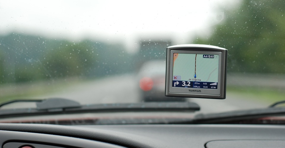
To do such a task, drones are outfitted with satellite location modules that allow them to geotag the images and data they collect. While GPS modules are the standard, more sophisticated drones boast of having redundant GPS and GNSS modules. What does GPS and GNSS mean anyway and how are they different?
What is GPS, and how does it work?
Perhaps it’s easier to preface this discussion with a discussion of what GPS is, given how ubiquitous the technology is nowadays. Far from its origin as a navigation tool used by the military, GPS technology can now be found in our phones, cars, and fitness devices small enough to be worn on wrists. How exactly does this work?
The Global Positioning System (GPS) was originally called NAVSTAR GPS. It is only one of several satellite-based navigation and location systems. The GPS network is owned by the US government and operated by the US Air Force.
Everyone with a GPS receiver can access the GPS network to receive accurate geolocation and time data. The network consists of up to 32 satellites orbiting the Earth, although this number can vary when older satellites get retired and replaced. Each of these satellites continuously transmits a radio signal containing information on its current time (as told by a highly stable atomic clock on each satellite) and location.
When a GPS receiver receives this signal, the time delay between signal transmission and reception is used to determine the distance of the receiver from the transmitting satellite. Since there are multiple transmitting satellites, a GPS receiver also receives multiple signals. The distance measured via these signals is calculated by the GPS receiver to come up with the most accurate geolocation.
A minimum of four satellites is needed to deduce a reliable location – three to triangulate the distance, and a reference satellite to estimate clock deviation. However, GPS receivers can also make use of signals from up to ten or twelve satellites for better accuracy.
Nowadays, most FAA-approved GPS receivers are capable of reporting locations with up to 3.5 meters of horizontal accuracy, although various factors such as meteorological conditions and the presence of nearby large structures can play key roles. All GPS receivers are regulated by the Federal Communications Commission (FCC). Nowadays, GPS technology has become an integral part of many scientific, commercial, surveillance, and military applications.
What makes GNSS different?

As we’ve mentioned, GPS is only one of several satellite-based navigation systems. Collectively, these systems fall under the umbrella of the Global Navigation Satellite System (GNSS). Each of the systems under GNSS maintain and use a different constellation of satellites. Major examples of GNSS networks include the Global Navigation Satellite System (GLONASS) which is owned by Russia, as well as the Galileo by the European Union, the BeiDou by China, the NAVIC by India, and the Quasi-Zenith Satellite System (QZSS) by Japan.
This may come as a surprise to most, given how common GPS devices are globally. The fact that GPS was the first GNSS network to offer global coverage means that it has become the network of preference for most device manufacturers. GLONASS, although it was developed concurrently with GPS, was only able to offer global coverage in the mid-2000s. Galileo is still under the testing phase but should be fully operational in one or two years.
In the coming years and as more GNSS networks come online, drones and other devices that can receive signals not just from GPS satellites but also from other GNSS satellites will have a huge advantage. Right now, this isn’t much of an issue since there are only two GNSS networks available for civilian use.
Why are there several GNSS networks?
Why the need for several GNSS networks and why can’t several countries just create and maintain a single, unified network? The answer, as with most global issues, lies in the sense of ownership, independence, and sovereignty of individual countries.
Although the GPS network is one of the earliest and the most popular satellite-based navigation system, the fact that it is owned and controlled by the US government cannot be ignored. As such, the US government can deny access to or degrade the quality of the GPS network as they deem fit. This is exactly what happened during the Kargil conflict of 1999, which saw Indian and Pakistan forces go to war in the Kashmir region. During the said war, access to the GPS network was denied to the Indian military.
As more and more countries recognized how dependent they have become on GPS networks for many critical operations, they have taken steps to create their own satellite-based navigation systems. Issues such as national security and tension between countries can also be used as grounds for jamming GPS signals – something that can cripple a lot of industries worldwide.
Should I get a drone with a dual GPS-GNSS module?
For commercial drone pilots, the loss of navigational capabilities because of national issues is probably less of a concern. If you are based in the US, then there’s probably no reason to fear a loss of access to the GPS network.
However, there’s still value in getting a drone or any device that can access more just GPS signals. Despite the global coverage of GPS, there are still areas in the world where its signals get weak. It may be the most reliable GNSS network we have right now, but it’s still not 100% reliable. The advantage of having a receiver that can utilize signals from other GNSS networks is that it can automatically shift to another network in case of a weak GPS signal.
The good news is that many drones available nowadays, even consumer-grade ones, typically come with dual GPS-GLONASS modules. This should be enough for most circumstances. In any case, GPS and GLONASS are the only two networks that have global coverage so far. Here are just some of the best drones which offer dual GPS and GLONASS tracking:
- DJI Mavic Air
- DJI Mavic Pro
- DJI Mavic 2 Pro
- DJI Mavic 2 Zoom
- DJI Phantom 4 Pro
- Parrot Anafi
- Parrot Bebop 2
- Yuneec Mantis Q
- Walkera Vitus
- Autel X-Star
Drones with GNSS modules belong to a league of their own. By being able to receive signals beyond just GPS and GLONASS, the navigation capabilities of such drones are much more reliable and future-proof. By building in BeiDou and Galileo signal reception, GNSS drones have more options for better locational accuracy.
Of course, this technology comes at a price. Drones with GNSS modules are usually those designed for professional mapping and are much more expensive than consumer-grade drones. If you are offering commercial drone mapping services, being able to access a wide selection of GNSS networks can be a huge advantage if you need to conduct mapping surveys in remote locations. It’s also a great marketing pitch, even if most people don’t understand the concept behind it.
Best drones with GPS-GNSS redundant modules
1. Yuneec H520 RTK
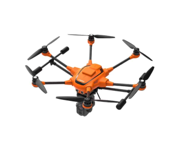
The Yuneec H520 RTK is an upgraded version of the already excellent H520 drone and is their entry into the RTK mapping segment. Like the base H520, the H520 RTK features a hot-swappable payload provision, allowing you to use it with any of the CGO cameras. Whether you want to do a thermal imaging survey or inspect power lines from a distance, the H520 RTK offers a versatile and reliable solution.
The GNSS module of the H520 RTK supports up to three satellite constellation networks. Right now, the choices are GPS, GLONASS, Galileo, and BeiDou. It’s unclear if the buyer has the liberty of choosing which networks to support or if the networks are region-locked, like the Phantom 4 RTK.
One of the major advantages of the H520 RTK is that it fully supports switching to a PPK workflow. As a background, both PPK and RTK share common objectives in improving location accuracy of surveys by correcting their data with a fixed ground station. PPK is typically perceived as the more reliable of the two since it doesn’t rely on maintaining a constant connection between the drone’s onboard module and the ground station.
There’s also the fact that the H520 RTK is one of the cheapest RTK-enabled drones in the market today. However, it needs to be said that it doesn’t come with a camera or any payload – you’ll have to buy those separately.
2. DJI Phantom 4 RTK
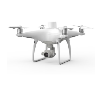
DJI’s first foray into specialty mapping drones was also one of their first drones to offer full GNSS capabilities. In the Asian market, the GNSS module of the Phantom 4 RTK can receive signals from the GPS, BeiDou, and Galileo networks. In all other markets, the Phantom 4 RTK has access to the GPS, GLONASS, and Galileo networks. Although the Galileo network isn’t up for access yet, all three Beidou, GLONASS, and GPS networks are operational.
The GNSS module is only one of the many impressive features of the Phantom 4 RTK. The RTK module allows for real-time correction of the drone’s locational data relative to a fixed ground station. This massively improves the locational accuracy of the drone to a centimeter-level. Combined with a 1-inch CMOS sensor camera, the Phantom 4 RTK is considered one of the best drones for photogrammetry.
Beyond its RTK capabilities, the Phantom 4 RTK isn’t exactly the most versatile mapping drone. It does not support switching to a PPK workflow without having to install costly upgrades. Given the $6000 (or higher) price tag, of the Phantom 4 RTK, any additional expenses don’t seem to be justifiable. Still, if you want a drone that can produce centimeter-level locational accuracy, high-resolution photos, and flies really well, you can do so much worse than the Phantom 4 RTK.
3. DJI Matrice 210 RTK V2
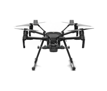
The Matrice 210 is one of the most versatile and rugged drones to ever come out of the DJI brand. It can support dual gimbals for simultaneous use of two types of cameras, an upward-facing gimbal, independent gimbal control, and much better protection against electromagnetic interference. It’s also one of the most weather-resistant and durable DJI drones. With the addition of an RTK module, the Matrice 210 has become further enhanced for centimeter-level drone mapping accuracy.
Version 2.0 of the Matrice 210 RTK comes with a true GNSS module that supports the GPS, GLONASS, BeiDou, and Galileo networks. The upgrade has made the Matrice 210 drone an all-in-one inspection and mapping drone – a commercial drone pilot’s dream come true.
The Matrice 210 RTK V2 is compatible with the whole range of Zenmuse cameras. It can even support selected third part sensors. While this level of versatility is certainly valuable, it can also get pricey really quick. With these factors in mind, we don’t expect the Matrice 210 RTK V2 to have lots of mass appeal. It was primarily designed for industrial use. The good thing is it probably won’t disappoint in that type of setting.
Final thoughts
GPS has become such a common feature in many of the devices we use every day that it’s become a colloquial term. What many people don’t know is that GPS is only a part of a much wider constellation of satellite networks collectively known as GFNSS. While US-based drone pilots are understandably less concerned with versatility outside the GPS network, having more options is never a bad thing. After all, the coverage of GPS is not absolute, even inside the US.
If you work in commercial drone-based mapping, GPS signal dropouts can easily ruin the quality of your map or model if your survey solely relies on it. With a GNSS module, the drone can easily switch from one network to another, depending on which has the best reception.
With more and more GNSS networks coming online and getting adopted by various industries, we expect GNSS receivers to become more common in the coming years.