Best LiDAR Sensors for Drone Aerial Mapping

There is probably no commercial application as uniquely destined to be revolutionized by drone technology as aerial mapping. With drones, mapping surveys conducted over large areas can be done at the fraction of time and effort it will take for the traditional mapping method. The automated nature of drone surveys also means that the data has a more consistent quality, and that surveys are infinitely repeatable.
Recent developments have combined drones with LiDAR technology to produce more advanced drone mapping and navigation solutions. This marriage of two high-end technologies is fostering a new era of highly sophisticated mapping drones. What is LiDAR anyway and what can you do with it? Read on as we discuss LiDAR technology.
What is LiDAR and how does it work?
Light Detection and Ranging (LiDAR) is an active aerial mapping method that uses a sensor that emits continuous pulses of light. These pulses of light typically have wavelengths between 1064 nm and 1550 nm, well outside the spectrum that is visible to humans. These pulses of light bounce off the solid objects inside the surface area. The reflected rays are then received by the same sensor. Using the data on the time it takes for each pulse of light to return to the sensor, a mapping algorithm can determine the size and location of the individual features within the area of interest.
LiDAR is a highly accurate mapping technology. By using multiple pulses of light that have constant speeds, a LiDAR survey can generate models made from very dense point clouds. LiDAR-generated models are typically accurate to 1 meter. With the right equipment and the use of ground control points (GCPs), the accuracy of a LiDAR survey can even be enhanced to about 1 centimeter.
By not being dependent on visible light, LiDAR surveys are also very versatile. A LiDAR survey can be done even at night and can capture features that would otherwise be concealed by larger structures such as trees and building. The light pulses that LiDAR sensors emit can penetrate through vegetation, allowing surveyors to model topography even when it is covered by a thick forest canopy. There have even been studies that used LiDAR technology to map the terrain of the ocean floor.
Compared to photogrammetry, post-processing of LiDAR data is less hardware-intensive and takes a much shorter time. It does not need to process thousands of overlapping images but instead only has to go through arrays of numbered data.
What is LiDAR used for?
The most popular use of LiDAR technology has been in the field of aerial mapping. The fields of agriculture and forestry have benefitted from the ability of LiDAR to penetrate vegetation and generate a model of the underlying topography in heavily forested areas. Mapping of urban environments is also best done with LiDAR as the presence of tall building and structures will obscure aerial images captured by any RGB camera.
The light pulses that a LiDAR sensor emits are not restricted to modeling features at the ground model. Drones with LiDAR sensors can be programmed to fly around buildings or any large structure to generate a 3D model of it. This is a great tool for structural inspection and for monitoring of construction projects. LiDAR can also be used to model small or thin objects such as power lines and railroad tracks, making them useful for corridor inspection jobs for specific industries.
LiDAR technology can be integrated with drones for obstacle avoidance in the same way that it is already being used in driver-less cars. By using pulses of non-visible light, LiDAR can detect obstacles faster than sonar technology and can identify them even in total darkness.
Although the use of LiDAR sensors for obstacle avoidance is possible in theory, the reality is that it is still not very common. Outside of the Kespry 2.0 UAV, there is probably no other ready-to-fly drone out in the market today that uses LiDAR for obstacle avoidance. The low rate of adoption comes down to one thing: the price of a LiDAR sensor.
What are the drawbacks of LiDAR?
The biggest hurdle that has limited the widespread adoption of LiDAR technology has been the much higher costs associated with it. A LiDAR sensor can cost between $50,000 to $300,000. The sensors also tend to be on the heavy side, requiring the use of a drone with a high payload capacity. For most enterprise-level applications, setting up a complete drone-based LiDAR surveying system will cost at least $350,000 – much higher than what small and mid-sized companies can afford.
LiDAR models are essentially just point clouds. They contain no color information, resulting in highly accurate but rather dull-looking models. They may also be difficult to interpret for audience who are not very familiar with the technology or the survey area. LiDAR models may not be the best option for models meant for advertisement or visual presentation. They most definitely cannot be used for applications requiring visual assessment, such as site inspection and crop health surveying.
What are the best LiDAR sensors today?
LiDAR sensors used to be so big and heavy that they had to be used onboard a helicopter and required a whole crew to gather data. In a very short amount of time, manufacturers have been able to miniaturize LiDAR technology, resulting in LiDAR sensors small and light enough to be carried by drones. Modern LiDAR modules also make use of cloud technology for quick data processing that does not require the user to have a high-powered computer.
1. LeddarTech LeddarOne LiDAR Sensor
The LeddarOne is a remarkable compact LiDAR sensor from LeddarTech. It uses a narrow but diffuse beam of non-visible light to determine its altitude off the ground, making it an incredibly accurate altimeter. This feature has been used to control the auto take-off and landing functions of some drones. The same technology is used by LeddarOne to detect objects and obstacles, making it a reliable foundation for automated navigation systems.
Its compact design makes the LeddarOne very easy to integrate to existing transportations systems and drones. The sensor comes with the Leddar Enabler SDK that developers can use to integrate the LeddarOne’s functions into their equipment. With no moving parts, the LeddarOne is an exceptionally robust and reliable sensor that consumes very little power. The LeddarOne is also one of the most affordable LiDAR sensors available today.
2. ScanLook Revolution
The ScanLook Revolution is a great entry-level LiDAR sensor that is incredibly easy to use and does not as much as higher-end models. This sensor is especially designed for drone surveys and is compatible with the super popular DJI M200 drone series. While it does not promise to deliver survey data with error margins less than 2 to 4 cm, it can perform close to this level of accuracy while being user-friendly and wallet-friendly.
At more than 1 kg, the ScanLook Revolution is a far cry from the compact design of some of the other LiDAR sensors. However, it offers three laser options: the Velodyne VLP-16, Velodyne PuckLITE, and Quanergy M8. The ScanLook Revolution is appropriate for surveys that do not necessarily require centimeter-level accuracy such as in volume calculation of stockpiles or law enforcement forensics.
3. LeddarTech VU8 Lidar Sensor
The LeddarTech VU8 is another compact LiDAR sensor from LeddarTech that is equipped with features that belies its size. At only 75 grams, it is one of the smallest and easiest to integrate sensors available today. Don’t let the size fool you – the V8 is capable of multi-target detection up to a range of 215 meters.
Its compact design and its use of a fixed laser source helps keep the price of the V8 down while giving it more robustness. It is a great sensor for use in high-traffic areas, as it has built-in tolerance for noise and other interfering signals. The V8 sensor has been integrated in the navigation and obstacle avoidance systems of semi-autonomous and autonomous vehicles such as heavy equipment, trucks, buses, and drones.
4. Velodyne HDL-32E LiDAR sensor
The HDL-32E LiDAR Sensor is a small and rugged sensor that was expressly designed for aerial 3D mapping. Weighing between 1 to 2 kg, it’s not exactly lightweight and will require the use of a drone with high payload capacity. It’s 32-channel lasers and 40° vertical field of view allows it to collect between 700,000 to 1.39 million data points per second.
The effective range of the HDL-32E is 80 to 100 meters, allowing the drone to fly at relatively higher altitudes. With low power consumption, the HDL-32E may be one of the best LiDAR sensors for surveyors who must face the toughest field conditions. The HDL-32E can generate models accurate to about 2 cm, making it an excellent for topography mapping. Although this sensor is not cheap, it may be one of the most reliable and rugged LiDAR sensors for mapping and surveying.
5. RIEGL VUX-1UAV
The VUX-1UAV sensor has the distinct advantage of benefitting from the year of experience of RIEGL in the laser scanner industry. For years, they have remained a big name in the field of augmenting unmanned airborne platforms, effectively revolutionizing both the civil and commercial market segments.
With the VUX-1UAV, RIEGL leveraged their experience to answer the needs of the drone mapping industry. With a sensor that claims to have up to 10 mm survey-grade accuracy, the VUX-1UAV may be on of the most accurate stand-along LiDAR sensors available in the market today. It can do up to 200 scans and collecting up to 500,000 data points per second. Data acquisition is facilitated by an ultra-wide 330° field of view.
Weighing up to 3.75 kg, the VUX-1UAV is by no means a lightweight sensor. It is loaded with the very best RIEGL technology for multi-target detection and waveform processing of data. It also has an operating range of up to 300 meters, allowing drone surveys to be conducted at much higher altitudes compared to the other entries in this list. Despite its size and weight, it is easily mountable to any of today’s popular enterprise-level drones.
6. Velodyne VLIP-16 Puck
The VLIP-16 Puck is a more recent release from Velodyne and is a smaller and lightweight alternative to the HDL-32E. It retains most of the key features of the Velodyne sensors, albeit in less capable forms. The use of scaled-down technology has allowed the Puck to maintain a highly compact build while also keeping its price down.
Despite its size, the VLIP-16 Puck has several excellent features. It has 100m range, and the 16 channels of laser pulses can collect up to 300,000 data points per second. Surveys are more easily and quickly done with the Puck’s 360-degree horizontal and 30-degree vertical field of view.
The biggest benefit of using the VLIP-16 Puck is its reduced weight. At only 830 grams, it is one of the lightest stand-alone LiDAR sensors available today. This allows the Puck to be used in a wide array of payload drones.
7. YellowScan Mapper II
The YellowScan Mapper II is an entry-level LiDAR solution that is completely turn-key and can be installed on most of the popular enterprise-grade payload drones. Its design is both visually appealing and robust, a testament to the quality of this product. The Mapper II was designed for fully autonomous operations and is equipped with a direct georeferencing workflow that increases efficiency and accuracy of mapping surveys.
Surveying using the Mapper II can generate models with accuracy of up to 5 cm in the Z-axis. The maximum functioning range of the LiDAR sensor is 200 meters, allowing the drone to hover much higher over the are of interest. The Mapper II is also equipped with RTK and PPK technology which can be used with an RTK GPS base station to achieve a much higher level of accuracy.
The Mapper II can be paired with an optional 24.3MP RGB camera that can interface with the LiDAR sensor for synchronized data collection. The YellowScan LiveStation is also sold separately and can be used for real-time in-flight LiDAR data monitoring. With all the possible add-ons, the YellowScan Mapper II is one of the most comprehensive drone-based LiDAR solutions.
8. Routescene UAV LiDARPod
The LiDARPod from Routescene is an ‘out of the box’ LiDAR solution designed specifically for use with drones. This turnkey device is easy to use and can be rapidly deployed. The bundle comes with the QA monitor web-based app that provides real-time data monitoring and the LidARViewer Pro desktop app that can be used for data visualization and post-processing. For enhanced accuracy, the LiDARPod also comes with a ground station that can be used for RTK GNSS corrections.
The LiDARPod truly lives up to its ‘out of the box’ claims as everything you will ever need to do a drone survey comes included inside the module. In addition to the LiDAR sensor, the LiDARPod contains a GPS module, radio telemetry, data storage, and built-in power management. Without the need for external components, the LiDARPod can be easily integrated into any UAV.
With its 32 laser sensors and detectors, the LiDARPod can capture up to 700,000 data points per second. It has an extra wide field of view of 41 degrees vertically and a full 360-degree horizontal coverage. The LiDARPod has a measuring range of 100 meters. The body of the LiDARPod is one of the most rugged out of all the LiDAR sensors as it has an IP67 rating for limited water protection.
Final thoughts
In the same way that drone technology has pushed the boundaries of aerial mapping technology, LiDAR is the technology that will serve to push these boundaries further. With the combination of drone and LiDAR technology, mapping surveys can be done to generate 3D models with centimeter-level accuracy. Depending on the LiDAR sensor you use, a drone can perform the survey by simply flying 100m to 200m above the survey area. In any case, drone surveys are much safer and faster than the traditional methods. In the long run, they can also be the cheaper alternative.
It’s true that LiDAR technology as it is right now is too expensive for small and medium-sized mapping companies. However, LiDAR sensors have also become cheaper year after year. It is only a matter of time before LiDAR technology becomes more affordable, and we fully expect it to be the new standard of the mapping industry by then.
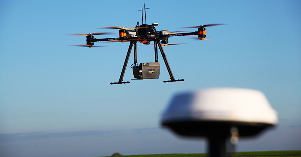
Image from Cargyrak under Creative Commons 4.0
Hi Joseph,
Thank you for your article on UAV LiDAR sensor mentioning YellowScan.
Please be aware that we do offer complete integrated LiDAR for Drone mapping solutions: Mapper2 (Ibeo based), Surveyor (Velodyne VLP-16 based), Surveyor Ultra (Velodyne VLP-32 based), Vx-15 and Vx-20 (both based on Riegl mini-Vux) and Vx-DL (based on Riegl mini-Vux-DL).
More to see here: https://www.yellowscan-lidar.com/products
Thanks for putting all together. It’s a Good resource for beginners. Just wondering if you have the info on data storage? I mean, VLIP-16 Puck sensor which is less than a kilo but if it is attached to the drones, does an additional hardware required to start the scan and store data on-board? Not sure how these sensors handle data. Any insight will be highly appreciated.
Ideal for mapping potholes and similar road defects en masse for repair I would have thought, though I do not see anyone offering this as a commercial offering or as a public service.