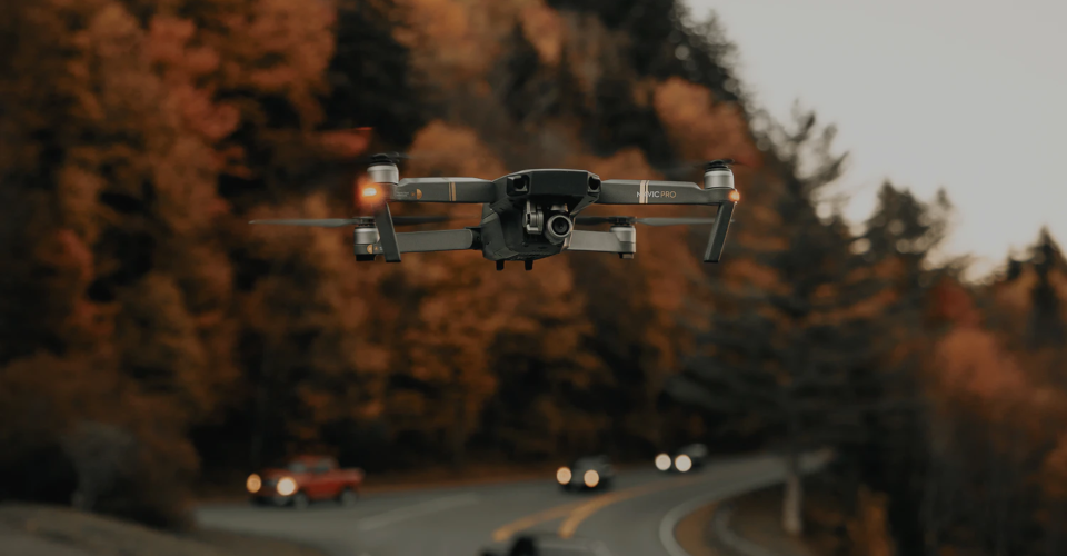
Who Uses Drones Today? A Brief Look at the Modern Uses of Drones

Drone technology first came into mainstream consciousness back in the 90s and early 2000s when they were used by the US military and the CIA for wartime surveillance and payload delivery. However, they had already been used several decades prior with similar objectives.
Today, drones are used in ways that are a lot more peaceful by comparison. There is now a thriving market for commercial drone services, serving the needs and complementing the capabilities of well-established industries. To emphasize how widely used drones are, here is a list of the people and professions who have embraced the unique benefits of drone technology.
Military
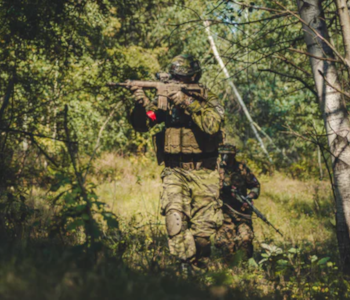
It’s hardly surprising, but the military remains one of the top users of drone technology. Drones are uniquely suited for deployment to enemy territories or any scenario that could present hazards to troops. Drones are also easier to deploy than helicopters and are much harder to detect. With their modern capabilities, drones have become stable tools for the military units of several countries including the US, China, Russia, Israel, Iran, and Pakistan.
As with the case several years ago, drones continue to be used by the military for surveillance. Modern drones are even more useful in this regard, as they are smaller, have better cameras, and are maneuverable enough to fit into tight spaces. Some units have even used aerial drones for bomb detection, although these have to be outfitted with special sensors.
Controversial but still worth mentioning is the use of drones for airstrikes. This type of drone use was placed in the spotlights during attacks in Pakistan by the US during the term of then-President Obama. Although it allows for attacks without endangering the life of troops, airstrikes using drones come with a lot of political, moral, ethical, and social issues. That is a topic for another day. However, it’s good to know that the technology that allows for drone airstrikes is highly restricted and inaccessible to the average drone pilot.
Photographers
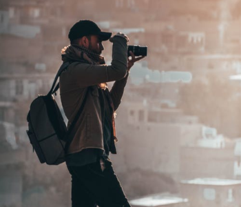
One of the most often displayed uses of this technology, aerial photography has become a huge draw for people who are curious about drones. Drones have made aerial photography very accessible, even for those who just want to do it for fun. More importantly, aerial photography has proven to be one of the most popular types of commercial services offered by drone pilots. Photos taken by drones have been used to advertise real estate properties for sale, popular tourism sites, and major sports events.
What makes modern drones especially suited to photography is the fact that they come with cameras that approach the level of quality and sophistication of many DSLR cameras. Depending on the model, drone cameras can have wide ISO ranges, adjustable aperture, HDR and auto-bracketing capabilities, panoramic shots, and sophisticated optical sensors.
Drones have become a favorite photography tool for outdoor and adventure junkies who like to have their activities documented. Whether for hiking, biking, or surfing, a lot of drones are equipped to keep up with the pace and ruggedness of many outdoor activities. Even better are drones that come with auto-tracking features, allowing the drone’s camera to stay focused on a moving subject. The possibilities with modern camera drones are virtually endless – and they are getting better every year.
Filmmakers
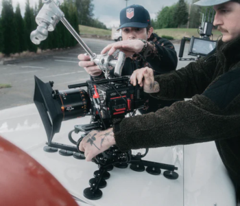
While aerial shots have always been a staple part of movies, drones have made them much more common. Aerial shots used to be expensive and time-consuming to shoot as they had to involve flying a helicopter with a cameraman on board. Nowadays, filmmakers and directors can simply deploy a drone to capture aerial shots. This is a process that can take just several minutes to a few hours. Buying a drone is also much cheaper than renting a helicopter.
One of the most useful components of a camera drone for filmmaking is the provision for a three-axis mechanical gimbal. A gimbal uses an array of sensors to cancel any erratic movement caused by the movement of the drone and the innate vibration of the drone. This results in aerial footage that is smooth and jitter-free. Gimbals, of course, have been used by the film industry for several years.
Another feature of drones that make them very valuable for filmmaking is their host of automatic camera modes. These features allow a drone to follow pre-set flight paths without any input from the pilot, pulling off maneuvers that would have been far too complex even for an expert drone pilot. These automatic flight modes can create highly dynamic aerial shots that can add an impressive flavor to any film.
News teams
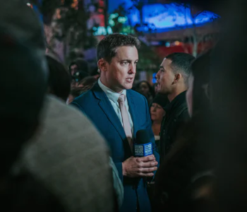
For the same reasons that drones are well-equipped for surveillance, they have also been used to great effect by newscasters to provide better context to news pieces and documentary content. When covering newsworthy events that involve large crowds or happen in wide-open spaces, the use of camera drones allows for documentation of the full scope of the event.
Safety is another factor in choosing to use drones for covering news events. In any area that is physically inaccessible or dangerous to reporters, drones allow for video documentation without exposing field reporters to hazards. Notable examples of such uses include coverage of Hurricane Irma and the California wildfires – events that would have been covered only with the use of helicopters.
Several large news outlets have included drones as part of their standard news coverage tools. One of the most high-profile organizations is CNN which has jumpstarted the use of drones with a program called CNN Air. With drone fleets distributed in more than 20 countries, CNN has one of the most extensive capabilities for aerial drone coverage.
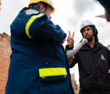
Disaster and emergency response
Emergency response is one of the more principled applications of drone applications, perhaps making up for the history of the technology as a tool for waging war. This category encompasses several types of emergencies – natural disasters, search and rescue, fires, health emergencies, and rescue operations. In any of these situations, the mobility and versatility of drones may make the difference between life or death.
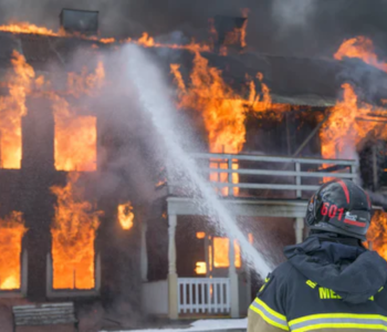
Fire response teams use drones in several stages of the response. Initially, drones can be used for reconnaissance to identify areas that are particularly hazardous or where firefighting response needs to be focused on. Once a fire has been put out, a drone with a thermal camera can even be used to check for leftover embers which may seem invisible but are still smoldering underneath. This allows firefighters to step in and put out these embers before they escalate into full-blown fires.
Thermal cameras mounted on drones have proven to be very valuable in search and rescue operations. Several documented cases have already demonstrated this. Thermal imaging, combined with the mobility and scope of view of drones, can locate missing persons in pure darkness or even in a bad snowstorm. In these situations, locating a missing person as quickly as possible is the most important thing for their successful rescue.
Lastly, drones can be used to deliver medical supplies and other supplies for the survival of people who are stranded and cannot yet be rescued. Despite the limited capability of most drones to carry heavy payloads, the fact that they can travel and drop off supplies in places that would otherwise have been inaccessible more than makes up for any of their limitations.
Law enforcement
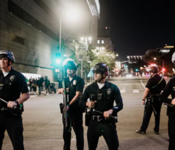
According to statistics, around 600 law enforcement departments around the US use drones to augment their capabilities in crime prevention and response. This is hardly surprising. Aerial response has always been an essential element of law enforcement, traditionally done via helicopters. Drones have become the preferred alternative because they are easier to deploy, more maneuverable, and several times cheaper than flying a helicopter.
Drones are commonly used by law enforcement agencies for regular surveillance. They work great in this regard because of how quickly they can cover a huge area, even compared to the effort of several squad cars. With a fleet of drones, law enforcers can cover their entire jurisdiction in an hour or less to check for any potential crimes.
If a crime is already underway, law enforcers can also use drones for advanced reconnaissance. The objective for pre-surveillance is to identify and locate victims or any distressed parties, as well as the suspects or any perceived risk. This allows law enforcers to come up with a strategy that allows them to respond to the situation without exposing them to unnecessary dangers.
Geographers and mappers
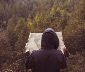
For geographers or any profession that does mapping or makes use of detailed maps, drones have proven to be a revolutionary tool. Not only have drones made the mapping process faster and easier, but they can even produce output that could have better quality and accuracy than old-fashioned surveying tools and methods.
The practice of aerial mapping wasn’t exactly developed just because of drones. As most of these stories go, aerial mapping used to be done via manned aircraft with a person onboard either taking pictures or operating advanced equipment. This was an expensive and tedious process that requires a lot of work and manpower and doesn’t exactly deliver the best results.
With drones, aerial mapping can be done either by equipping the drone with a high-resolution camera or with a LiDAR sensor. The best thing about drones is that they come with their own GPS receivers and can be programmed to automatically fly along pre-established flight paths. This means that drones can handle geo-tagging of all the data it collects and can fly even without manual pilot control. The precision and repeatability of automated drone mapping make it much more reliable than any method that is prone to human error.
Today, drones are considered the standard tools for any type of mapping. They have greatly simplified the process of creating maps. In turn, these maps have been used to build roads, buildings, mines, farms, or any other large-scale construction project.
Civil engineers
Proving just how versatile they are, drones have been used by civil engineers to aid in just about every stage of a construction project. It all starts with planning, aided by topographic maps that can be generated via aerial mapping. Whether via photogrammetry or LiDAR, the 3D maps generated by drones can be navigated, altered, and measured in infinite ways. Such level of detail comes in useful when planning for the costs, construction materials, and the need for preparatory works such as road building or slope stabilization.
During the construction phase, drones can also be useful for surveillance and progress monitoring. They are useful for providing updates to project managers, even if they aren’t physically on the site. The mapping tools of a drone can even be used during this phase to calculate for the volume of stockpiles in the site for proper and timely resource allocation.
Once a construction project has been completed, a drone can be used for final inspection and documentation. In the same way that a drone can generate 3D maps, it can also be used to create a detailed 3D model of an entire building. A drone also provides a safe and convenient way to check the building for any defects, even at great heights, without exposing anyone to fall hazards. With a thermal camera, the drone can also be used to check for any leaks in the building’s insulation.
Archaeologist
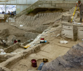
Archaeological sites typically have to be explored and documented with the utmost care and scrutiny. Not only do archaeologists need to document every historical artifact and evidence, but they have to do it in a way that preserves these artifacts as much as possible. Exacerbating this job is the fact that these archaeological sites can be quite hazardous to enter. There are also archaeological sites that may be inaccessible or too large to capture in the scale of ground-based photography.
The use of drones in archaeology is still an uncommon practice, as it is still a field founded on old-fashioned practices. However, archaeologists who have embraced this new technology have found that their lives are made a little easier by the use of drones. Even before an archaeological dig starts, a quick aerial survey can be done to identify points of interest. This can save several hours of walking in the field – an accepted part of archaeology.
Once a site has been excavated, archaeologists can use a drone for low-altitude documentation and mapping of the site. Aside from generating a 3D map that they can navigate through and measure, the photos can also come in useful when analyzing an archaeological dig. In the past, this type of job was done using balloons or kites. With drones, archaeology can become a field where the future and the past figuratively meet somewhere in between.
Farmers
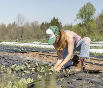
Another old-fashioned practice where drones have the potential to be useful is agriculture. This is one of the more unique applications of drones. Equipped with a multispectral sensor, a drone is an essential tool in the practice called precision agriculture, which uses various sets of spatial data for farm management.
Multispectral sensors are quite unusual in that they are sensitive to energies at frequencies outside of the visible spectrum. By combining the data collected from different electromagnetic frequencies, farmers can extract parameters that indicate the health of crops in different areas of a farm. This allows for smart and data-driven crop management, allocating resources such as fertilizers and irrigation where they are needed the most.
The beauty of drone-aided precision agriculture is that it allows for rapid data collection, even for farms that span hundreds of hectares. As you can imagine, doing this data collection on foot can easily take several days to a few weeks.
A far less common use of drones in farms is for crop spraying. This is rare because there aren’t many drones with the capability to hold a tank for fertilizers or insecticides and spray them in a fine mist. However, it’s easy to imagine how such technology can make the lives of farmers much easier. If this type of drone technology takes off, crop spraying can be done in a smart and even manner without the farmer even stepping foot on the farm or exposing themselves to potentially harmful crop treatment chemicals.
Meteorologists
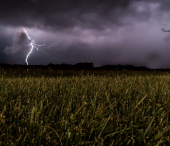
While lightweight drones aren’t exactly known to withstand very strong winds or severe rainfall, that has not stopped meteorologists from using them to take a closer look at unusual weather phenomena. The idea is to use drones in the same way that stationary weather sensors collect data on wind speed, temperature, pressure, and humidity. The biggest advantage of drones is that they can be deployed wherever these anomalous weather patterns develop.
The data collected by drones when they fly into hurricanes and tornadoes can help in determining their patterns, thus allowing for more accurate weather forecasting. Since drones are unmanned, they pose no risk to human life whenever they fly into the inhospitable conditions of a hurricane. This principle can even be extended to water-borne drones – by their own right, these water-borne vehicles can be called drones as long as they are unmanned.
The wisdom of flying drones into a hurricane when organizations such as NASA and the National Oceanic and Atmospheric Administration are leading the initiative. In many cases, it’s not just one or two drones that are sent into extreme wind and rain. For the sake of climate science, these organizations can send an entire swarm of drones into hurricanes and tornadoes to maximize data collection. This is the kind of job best left to the experts.
Wildlife conservationists
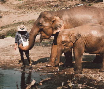
People who work for wildlife conversation have found a new tool in their arsenal once drones became easily available. The number one reason for the use of drones for wildlife conservation is to detect and prevent poaching. This is a major factor in the dwindling numbers of many endangered species. By using drones, wildlife conservationists can instantly expand their scope of surveillance and significantly reduce the possibility of poaching.
On a more academic note, drones can also be used to help record and analyze the behavior of animals in the hopes of understanding their behavior. Wildlife conservationists do this in the hopes of helping them preserve their habitat or find better methods to reproduce. Unfortunately, the mere presence of humans can disturb these animals and discourage them from exhibiting their normal behavioral patterns.
Drones offer a way for surveillance of wildlife that is non-invasive. Although it can be argued that drones aren’t exactly silent enough to not be noticed by animals, the mere fact that they are not people may mean that they are less of a disturbance in the normal habitat of animals. Drones can also be equipped with thermal cameras so they can continue surveillance at night.
Drone racers
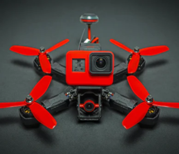
Just like cars, drones are as much used in practical applications as they are for fun. The most extreme form of entertainment using drones is done via drone races. And why not? Drones are very fast, highly maneuverable, and can be flown in FPV for that additional adrenaline rush. Drone racing has gotten so big that there are global professional leagues dedicated to this new sport.
For those who are interested in getting into this field, we have one major warning – you’re not likely to get very far with a drone that you can just buy off the rack. Practically all of the high-performing drone racers use drones that they have built themselves or modified so heavily that they barely resemble how they were sold originally. Drones used in races are highly stripped down to keep as them as light as possible, yet powerful enough to make sharp turns and complex maneuvers.
Drone racers are the top users of FPV goggles – headsets that provide an immersive view of the drone’s onboard camera. The experience is akin to being an actual pilot inside of the drone. This adds another layer of complexity to the skills that a drone racer must have. Indeed, drone racers are some of the most skilled drone pilots, able to negotiate through small spaces and make split-second decisions.
Final thoughts
From its flawed origins as a tool of war, drone technology has gone on to become a technology that many would consider disruptive. It’s hard to argue against this affirmation given how drones have revolutionized so many industries. From filmmaking to wildlife conservation and police work, drones have given humans a brand new perspective and a fresh approach to solving problems that are as old as humanity.
What’s even more exciting is the fact that drone technology is still very young. With such a thriving market, drone manufacturers seem to be on a race to come up with the latest and most innovative features. Soon, we might see parcel delivery by drones become a common sight. How does food in a restaurant served by a drone sound? Just as with any new and burgeoning technology, drones will inevitably go through growing pains before they can be fully developed.
Trying to find a company in the northeast that uses thermal drone technology for solar imaging and or maintenance. This is a new field that I would like to get started if no one else has. I would appreciate any information you might be able to share,