A Guide to Getting Started with Drone Topographic Surveys

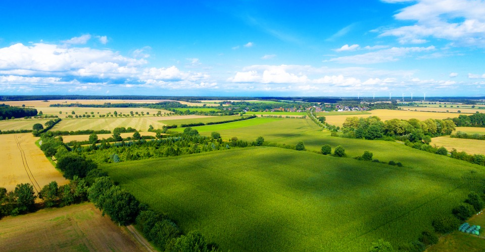
It’s been said many times before, but it’s a truth that’s worth repeating – no other industrial application is more well-suited to drone technology than aerial mapping. Drones have managed to revolutionize the mapping and surveying industries, helping companies acquire maps and models cheaper, faster, and using safer methods.
However, mapping isn’t something that an average drone pilot can just jump into. To succeed in this field, a drone pilot needs to have specialized knowledge of survey planning, data processing, and map creation. How can a drone pilot get into this gig? Is it going to be worth all the effort?
You need a drone license to fly commercially. The FAA will give you one if you pass the Part 107 exam.

PART 107 Made Easy
- 161 Question and Answer Study Guide
- 105 pages of illustrated content
- Covers all parts of the Part 107 test
- $97 of value for free
A brief history of topographic surveying
A topographic survey, as its name implies, is a survey that determines the topography of a piece of land by measuring the elevation of individual points and reconstructing a model from these points. Also known as land survey, the data produced by this technique allows for the accurate identification and measurement of either natural or man-made structures within the survey area. The result of the processed data from a topographic survey is usually either a map of contour line showing points of equal elevation, or a fully-reconstructed 3D model of the area’s topography.
Back in the 1950s, land surveys were done purely using ground measurement techniques. Although measurements made on the ground are very accurate and reliable (so accurate that these techniques are still used nowadays), they are simply impractical for covering large survey areas. They were also limited to areas that were easily accessible to humans – after all, trekking through forests and mountains while lugging along all the survey equipment did not sound like an appealing idea.
Although aerial photography had been a well-established practice long before this time, it was mostly used to take photographs of enemy camps during wartime. Indeed, it was with the military’s help that the technology marrying aerial photography and stereoscopy – the technique of combining two photographs to create a composite image with depth – was developed. This paved the way for the most primitive way of aerial mapping where multiple photographs were captured aboard a manned aircraft and painstakingly reconstructed.

The technology to create topographic maps using aerial photos allowed for mapping of otherwise inaccessible areas. With this technology, the US military was able to create faithfully recreated maps of war-torn areas that they used to craft detailed plans for their operations. However, there was a huge limitation. A single mapping project using manned aircraft could cost anywhere between one to five million dollars.
This problem became an opportunity for drone technology to shine. The earliest documented use of a drone for aerial mapping was in the 1935, when the British military used the radio-controlled DH.82 Queen Bee as an alternative aerial mapping tool. It took several decades before drones became widely accessible, but here we are: the golden age of drones.
What’s the importance of topographic maps?
It’s easy to imagine how important topographic surveys are to any civil infrastructure project. In fact, it’s such a critical part of the project preparation and execution process that land surveyors are usually one of the first people you will see in the project site. The resulting topographic map will form the foundation for engineering drawings and designs.
Measurements made on the fully navigable 3D model will allow project engineers to determine how much road needs to be laid down and how much soil needs to be excavated. It also provides an opportunity for geological hazards to be identified early in the project so that the proper mitigating measures can be put in place.
In urban settings, topographic surveys are also conducted to generate a 3D model of the surrounding environment of the project. Although most of the man-made structures captured by a topographic survey are also visible to the naked eye, the survey can capture a few things that a human observer may miss. These can include subtle changes in surface elevation, boundary location, water features, tree locations, drains, and the presence of power lines.
Why use drones?
With the surge in popularity of drones as a mapping tool, surely there must be a lot of benefits to using this technology. Drone-based mapping has all but replaced other methods of aerial mapping, although measurements are ground level can still be done to greatly enhance the accuracy of a drone-based survey. What makes drones such a good fit in the field of mapping?
1. Cheap
If you want to do the traditional way of aerial mapping, the easiest way would be to rent a helicopter and to hire a professional photographer. All in all, this service could cost you at least $1800 per hour. Exceptionally large jobs might even require several days to complete, so you can just imagine how easily these costs can pile up.
On the other hand, you can get a high-end professional-grade drone for the amount that you will pay for one hour of a helicopter rental. The drone is yours to use as you please – the recurring costs of drone ownership are very small. Even if you load up your drone with all the best accessories and high-quality cameras, your total should just end up between $5000 to $10,000. This is a huge discount from helicopter rental rates, and your equipment should serve you well for the next several years.
2. Fast
Although a helicopter has a much higher ground speed than any drone, movement speed isn’t the name of the game when it comes to aerial mapping. After all, the aircraft still needs to move slowly enough so enough aerial images can be captured. Where a drone truly shines is in how fast a professional mapper can have it up in the skies. There is no long refueling process, no long pre-flight checklists – just make sure you have a charged battery, that all your drone’s sensors are calibrated, and that you have the permit to fly your drone in the survey area.
3. Accurate and repeatable
If you end up using drone to do aerial mapping, chances are that you won’t do much flying yourself. Popular drones available nowadays are compatible with many survey planning apps that can automate the whole drone flight path for you. All you need to do is to define the area that needs to be surveyed, and the app will come up with a flight path. How fast the drone flies, the movement of the gimbal, and how many images will be captured will all be handled by the mission planning app.
Aside from the convenience that this feature offers, a fully automated process avoids the uncertainties and errors inherent to human-driven operations. There will be no chance that your survey results will suffer because you were flying a little too fast or erratically along the prescribed flight path.
Most apps even allow you to save the parameters used for completed surveys so you can use them again. This makes drone-based surveys completely repeatable, which may be a useful tool when monitoring changes in topography or elevation over time.
4. Versatile
One thing you need to remember about your mapping drone is that it doesn’t have to stay in the confines of mapping. If you’ve built a rig to conduct aerial surveys, then your drone setup should be good enough for a huge number of other commercial applications. Drone photography is always big. Since you already have a good drone with a high-quality camera, why would you pass up the chance to earn a little extra cash? Construction companies might even be interested in getting your services for inspection of their facilities. Just make sure that you have your Part 107 license.
Also, your drone doesn’t have to be used strictly for business. Don’t forget that flying a drone is fun. Why not take the weekends off and bring your drone to a beach? You can even just enjoy zipping around with your drone in an open field.
Factors to consider when going into drone-based topographic surveying
Like what we’ve said before, drone-based mapping probably isn’t for everyone. Aside from developing mastery of drone flight, you’ll have to be familiar with the apps and software that will aid in the collection, processing, and interpretation of survey data. Before you get started with your drone mapping career, here are the things you’ll need to consider:
1. Drone type and model
If you’re going to do drone mapping using photogrammetry, then all you need to have on your drone is a high-resolution camera and a GPS module. Any professional-grade drone from a reputable brand will do, such as the Phantom 4 Pro or the Yuneec Typhoon H Plus. When using these drones, the cameras and GPS work together to create geotagged images which will be matched pixel by pixel by a processing software to generate a 3D model.
However, drones fit for photogrammetry have a glaring limitation. Since they rely on cameras, mapping surveys done in heavily forested areas will just end up catching hundreds of images of trees. Standard cameras have no capability to pierce through canopy cover to see the underlying topography. Thus, you may end up with a very inaccurate topographic map.
In these cases, you’ll have to defer to a powerful LiDAR sensor. This type of sensor relies on the time difference between emission and reflectance of thousands of laser pulses, allowing it to infer the size of features within the survey area. The nice thing about these lasers is that they can penetrate through vegetation to capture a more accurate picture of an area’s topography.
Unfortunately, a LiDAR sensor isn’t something on any stock drone model, no matter how expensive it is. For such a specialized sensor, you’ll have to rely on drones with flexible payload mechanisms such as the DJI Matrice 600. The superior lifting power and flight stability of the Matrice 600 are well-suited to a drone LiDAR survey.
2. Survey methods
What many guides on drone-based surveys fail to mention is that you cannot rely on just the results of your survey if you would like to produce a truly accurate topographic map. You will still need to make measurements on the ground in the form of Ground Control Points (GCPs).
These points are indicated by high-contrast indicators that make them stand out in the aerial images taken by a drone. The location of these drones along a geodetic coordinate system are measured to the highest level of accuracy possible since they will serve as “anchors” for the topographical map produced by the survey.
As a professional drone mapper, it will be your call on whether you need to use GCPs or how many GCPs you’d like to use. A survey with more GCPs will always be better but marking GCPs is a really tedious and long process. It can also set back your project, as accessing these GCPs may not be as easy as flying a drone over them. In the end, it’s a compromise between several different factors.
3. Survey planning software
Hopefully, you aren’t planning on manually flying your drone and snapping hundreds of aerial images. Nowadays, survey planning is as easy as installing an app on your phone and connecting it to your drone. There are a couple of popular options for both beginner and experienced drone mappers. Pix4D, DroneDeploy, and PrecisionMapper are some of the more reputable end-to-end mapping software solutions that we can recommend.
If you have a DJI drone, then your best option is to use the DJI GroundStation Pro. This is DJI’s very own survey planning and flight management app. With the DJI GS Pro, you can do detailed mapping projects even with the ultra-portable Mavic Pro. The base map that the app uses comes from Apple Maps, so it comes with the limitation of only being compatible with Apple devices.
4. Data processing software
Once you finish a photogrammetry survey, you will have hundreds or thousands of overlapping aerial images that need to be matched to each other, pixel by pixel, to generate the topographic map. This step requires a lot of processing power, more than what most desktop computer setups have.
To bypass this problem, most map processing software platforms offer cloud-based processing. This works by uploading all the images captured in the survey to the developer’s cloud server where it gets processed by their more powerful computers. The results can then be downloaded by the user.
The end-to-end mapping software platforms we mentioned above (Pix4D, DroneDeploy, and PrecisionMapper) all offer this service. There are also a few excellent open-source options (such as WebODM) which can be used for free, given that you can overcome the initial technical hurdle to using them. In any case, these software platforms may vary in the types of output that it can offer to its users, but all the basic output types should be covered. These include 3D models, contour maps, orthomosaics, and point clouds.
5. Mapping software
A 3D topographic model, as simple as it looks when you first see one, contains loads of information that you can analyze and manipulate to serve several industrial needs. You can highlight areas that correspond to an altitude threshold, do slope analysis to identify geological hazards or identify rivers and streams for potential sources of water.
To manipulate the 3D model’s data or to derive more information out of it, you will need a good GIS software. ArcGIS is pretty much the gold standard, although you can still get good results by using the free version of QGIS or GlobalMapper. From basic functions such as distance, area, and volume calculations, to creating profile graphs or statistical analysis, these GIS software platforms can greatly expand what you can do with your data.
Being a GIS expert is also a lucrative career option, perhaps even more lucrative than being a professional drone pilot. If you’re looking to develop a niche career, one that not many people are capable of, then developing skills in a GIS platform will be a very good move.
How much can a drone pilot in this field earn?
Ultimately, all professional drone pilots are concerned with how much they can earn. After all, there’s a sizable investment that needs to be made in the equipment, training, and certifications before one can be called a professional drone pilot. So, how much can a drone pilot earn in the mapping and survey industry?
The answer isn’t so straightforward. Even with a huge number of professional drone pilots, the commercial drone industry is still so young that there really isn’t a standard rate for specific services. Right now, pricing schemes are still highly region-specific. How much a drone pilot can charge in major city might be too much for another pilot in a rural area. Even within the mapping industry, prices can vary according to the level of mapping resolution you offer and the deliverables you commit to the client.
Most drone mapping professionals fix their prices between $100 to $200 per hour. This is for a minimum package of deliverables that typically include orthomosaic maps and 3D models. If you offer other services, such as precision agriculture maps or thermal imaging, then you can add a premium to the per-hour rate. Highly experienced drone mappers can even charge as much $500 per hour. There are also industry clients that typically require higher resolution data. Thus, drone mappers can charge higher from the mining and oil and gas industries.
No matter what rate you charge, keep in mind that you need to make a profit not just from the initial capital you invested for your equipment and training. You will also need to take note of recurring expenses such as your software subscription, or the amount you pay for the hosting of your commercial website. Depending on the job, there might also be some business expenses for travel or your drone consumables and spare parts.
Final thoughts
Building a career as a drone pilot doing topographical surveys takes a lot of work, not to mention a sizable financial investment. To be successful, you will need also need quite a lot of technical knowledge on how orthorectification of images work and how to use GIS software platforms. It may not be for everybody, but it sure pays well.
The good news is that professional drone mappers have the potential to earn much more than a typical professional drone pilot. The work is hard, but we hope that the guidelines we have provided will get you started on the right track.